The Ordnance Survey Map showing Leith Hill in Surrey.
Friday 13th March, the Coronavirus is now causing
us to “social distance.” We are still wondering what, ”social distancing,” actually means in
practice. Toilet rolls are disappearing like,” hot cakes,” off TESCOS
supermarket shelves. Is that a good analogy? The sudden need for
toilet rolls is leaving many of us bemused. We are beginning to feel cautious
about meeting people and we have decided that going to the local pub or
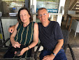
restaurant is not a good idea at this time. John, Tony and myself still,
however, felt confident about driving to, Leith Hill, within our cars. Walking up steep inclines and along the muddy tracks
dissecting dense woodland, didn't bring us into contact with anybody. Boris Johnson and the
chief medical officer for England, have assured us that taking daily exercise in
ones and twos is a beneficial thing to do at this time. Very few people were
about and those we encountered could easily be kept at a distance.

The way to the top of Leith Hill from Landslip Car Park.
Leith Hill is the second highest
point in the south east of England at 294 metres in height above sea level. It is an
SSI site (a site of special scientific interest). The area around the hill
supports rare moths, many examples of fungi, all three types of British
woodpecker and a large and varied invertebrate community. It is part of the
Greensand Ridge which, in turn, is part of the Artois Anticline which covers South
East England and Northern France. This geological stratum was laid down in the
Cretaceous period 145 to 66 million years ago. Greensand is a sandstone
escarpment consisting of ironstone and Bargate Stone, an extremely hard
stone. The sandstone is overlain by
chalk and clay deposits. This diverse substratum attracts many species of trees
and wild flowers.

Leith Hill Tower on the summit of Leith Hill.
On the summit of Leith Hill is an 18th century
tower built in the Gothic style. It was built between 1765 and 1766 by Richard
Hill who lived in nearby Leith Hill Place. It was at first called Prospect
House, but this later changed to Leith Hill Tower. It is 19.5 meters high. In
the 18th century visitors to the tower were provided with, “prospect
glasses,” similar to binoculars. Nowadays there is a telescope for visitors to
view the scenery. The south coast can be seen from the top on clear days.
Leith Hill Place, seen nearby from the tower was originally
owned by Richard Hill who had the tower built. When he died in 1772 he was buried
underneath the tower. It fell into ruin after his death. It was later reopened
in 1864 by a Mr Evelyn of Wotton House situated to the north of Leith Hill. On
the parapet of the tower there is a viewpoint indicator that commemorates
Edmund Seyfang Taylor, an early pioneer rambler. Leith Hill Place was later owned, in 1847, by Josiah Wedgewood III and Caroline, his wife. Josiah and Caroline
were the grandparents of Vaughn Williams, the composer. Vaughn Williams spent
much of his childhood years at the house and later inherited it and eventually
left it to The National Trust. There is an exhibition about his life at the house. Caroline Wedgewood was a member of the Darwin family and
Charles Darwin often visited Leith Hill Place and conducted experiments in the
grounds.

The Ordnance Survey triangulation point at the top of Leith Hill.
At the top of Leith Hill next to the tower is an Ordnance
Survey triangulation pillar. It is the position where the 6 inch and 1:2500
Ordnance Survey maps for Surrey originated from.
Tony and I parked in Landslip Car Park in a wooded area below the summit.
John, parked on the other side of Leith Hill. We arranged to
meet next to the tower. When Tony and I arrived at the top there
was no sign of John at first. Then we noticed a vigorously waving person calling
down to us from the top of the tower. My first thought was of the Monty Python
film, The Holy Grail when a French knight in armour shouted insults in a bad French
accent at the attacking English force. No insults, in bad French came our way. We climbed the narrow steep spiral staircase to
the top and joined John. The view was breath-taking. It was a clear
day and we
could see to the horizon. Some riders on horseback emerged
from woodland near the base of the tower as we looked down.

Horse riders at the base of the tower.
A lady serving tea in the National Trust café in the base of
the tower assured me that the area of grass just outside the tower was where
the recent Jane Austen film adaptation of the Box Hill picnic scene from the
novel EMMA was filmed. The 2020 version of Emma, directed by Autumn de Wilde
and starring Anya Taylor Joy and Johnny Flynn in the starring roles is worth
seeing. It is a version of Emma for today. Some Janeites disapprove of it. The real Box Hill is only a few miles away from Leith Hill on the other side of
Dorking. Nowadays it is a great attraction for cyclists, walkers and family
picnics, so perhaps it is too busy for filming purposes. The elevation of Leith Hill and the panoramic views form the
top are virtually identical to the height and views from Box Hill.
Nobody would know.

The site used for the picnic party on ,"Box Hill," in the latest film adaptation of Jane Austen's novel EMMA.
From here we used an Ordnance Survey Explorer map (Dorking,
Boxhill and Reigate 1:25000 scale) to work out a route, walking north west to
begin with, taking us from the summit of Leith Hill. A group of scots pines stand majestically at the top of Leith Hill and we started our walk
underneath their spreading canopies. Descending the slope of Highashes Hill, to
one side of Leith Hill. we made our way down a steep muddy slope through mixed
deciduous and coniferous woods. Silver birches, pine, larch, interspersed with
a few large oaks constituted the woods. Walking has a number of advantages. You tend go at a slower pace,
especially when the going gets difficult. You have time to look and listen and
take in the natural world around you. We approached High
Ashes Farm. The farm house, barns and sheds were grouped in an open space.

High Ashes Farm.
From High Ashes Farm we walked on into woodland again,
passing through Burnthouse Copse, Great Foxmore Wood and Rosiers Wood. As we slid and stumbled along one very muddy path we came across a car, smashed and
dented, hidden within the trees and undergrowth. It appeared somebody had
driven it there along the muddy track. It had off road tyres and the exhaust
pipe was positioned like a mast sticking up above the car bonnet. We checked
nobody was inside. It didn’t look as though it had been their long.

Wrecked and abandoned car in the woods.
Further on we passed Hopedene Farm. The three of us emerged onto the Horsham Road
with a few houses hidden behind tall hedgerows and trees here and there. This
was the outskirts of Holmbury St Mary. The village is situated on the sides of
a steep ravine cut into the Greensand ridge within the Hurtwood Forest which is
reputedly the largest area of common land in Surrey. It is unusual because its
geographical location places it in two different borough councils. Most of the
village is in the borough of Guildford within the Shere civil parish. The east
side of the village street however is within the Mole Valley District within
the Abinger civil parish. People in Holmbury St Mary pay their local council
taxes to two authorities.

Holmbury St Mary, seen from the churchyard of St Marys.
As we entered the village we were passing
St Marys church and decided to look inside. We walked through the graveyard to
the church entrance. From here, because the church is situated on the hill side,
we got a clear view of the main part of the village and the hills surrounding
us. The interior of St Marys is in the gothic style, much copied by the
Victorians. Stained glass windows streamed
coloured light into the interior. A calm,
meditative place.

The interior of St Mary's Church Holmbury St Mary.
Originally the village was called Felday. St Mary’s, was built there in 1879, paid for
by George Edmund Street who also built himself a large house in the village
called Holmdale. He had the village renamed after Holmbury Hill, which
overlooks the village and the name of the church, put together. The village has
two styles of architecture, the Woodhouse copse style, an arts and crafts style
designed by Oliver Hill in 1926 and Jolwynds, a modernist house, also designed
by Oliver Hill in 1926.

An arts and crafts style of house in Holmbury St Mary.
There is a well in the middle of the village where Tony,
John and myself took photographs of ourselves posing with the winding mechanism
under the oak supported tiled roof shading the well. After asking a passing local the way to the pub we retired to The Royal Oak where we were welcomed by
a cheery barmaid. We found a corner table near a window overlooking the front
of the pub and settled down. The pub has its own microbrewery and so we ordered
the house beer, three pints of,” Felday Special.” Always the sight of fish and
chips on the menu is an attractive prospect so we also ordered three fish and chips
too. The beer took a while to arrive because the landlord needed to put on a
new barrel. After putting the new barrel on tap he came to talk to us and we
learned that the fish we were about to eat came fresh from Cornwall every day.
He also told us about his beer brewing exploits. The fish and chips were superb.
I haven’t eaten such well-made chips in a pub for a long time. The beer went
down well too and if we were not moving on I could have stayed and drunk
another pint. What we only noticed when we got outside the pub and were walking
away was that the receipt I was given for our beer and food was rather cheap. Tony
realised, that because we had had to wait for the beer to be served, the
barmaid hadn’t charged us for the beer. I for one am going back to the Royal
Oak in Holmbury St Mary. How good is that?

The Royal Oak pub.
We made our way through the village looking at some of the cottages and a small field laid out as allotments where people are growing their
own fruit and vegetables. We passed Felday Chapel on the rise of ground to our left,
as we walked on. It is a 19th Century
Congregational Chapel. The Congregational Churches are
independent religious groups that hark back to the Puritan tradition. They are non
conformists . This tradition is much simpler and less elaborate than the Church
of England services held at St Marys on the other side of the village.

Felday, Congregational chapel.
The
village is reputed to be a template for the Surrey village portrayed in E. M
Forster’s ,”A Room With A View.” E. M. Forster was brought up in Abinger Hammer
nearby and knew the Surrey Hills well.
A path took us off to
the right in a north easterly direction up a steep hill. We plodded up this high slope through
a wood of tall.slender larch trees. A young deer hurried through the trees
near us and disappeared into another part of the wood. We eventually reached
the top of the hill and came out onto a plateau with an area of felled trees
and a wide woodland path. We began to lose our position on the map but Tony
decided that with the sun in the sky on our right, our final destination, back
at Leith Hill Tower was south of us. We carried on eastwards through the
woodland covering the crest of the hill
and came across some converted farm buildings. They appeared to be wealthy homes
with Range Rovers and Porche sports cars parked in their drives.

John and Tony walking onward and upwards.
We walked on through ,”Pasture Wood,” and crossed Pasture Wood Road into a lane which we thought took us in the correct direction. In front of us was a magnificent arts and crafts, Mock Tudor, mansion. Manicured sports fields spread out in front of it. Some teenagers were being taught football skills by a sports teacher. We stopped for a moment to work out our route once more.I later found this school on my OS map. It is called
Hurtwood House School.
This is a statement on the school website.
“ Hurtwood combines the best elements of the traditional boarding
school system with the best elements of the modern sixth form college to create
a wholly unique and individual establishment.
While breaking new ground educationally, it has retained traditional
values and has created an inspirational but safe stepping-stone between school
and university.”
I read on about its educational philosophy and I must admit
I was impressed. It’s teaching methods are creative and child centred. It is a fee paying, private school.
The building, Hurtwood House School is based in, has an interesting history. It was built originally for Beatrice Webb and became the
centre,between 1947 and 1986, for the, ”Webb memorial Trust for Rethinking Poverty.“
Beatrice Webb helped her cousin
Charles Booth in creating his poverty map of London in the late 1890s and early 1900s and she contributed
new ideas to political and economic thinking. Along with her husband, Sydney
Webb and George Bernard Shaw she helped found the London School of Economics.
She supported the cooperative societies.
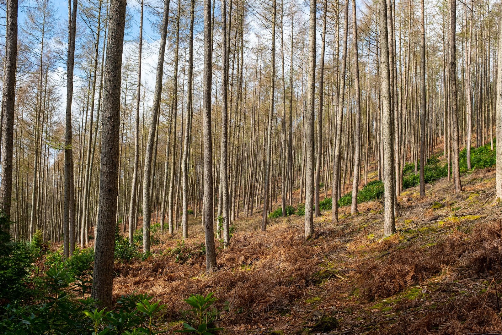
Larch woods.
Tony, John and I walked on uphill now, keeping Leyland Farm
and Leylands Road to our left until we branched south and, as we hoped, made
our way back up to the summit of Leith Hill. We got back to Leith Hill Tower,
rested for a while looking out over the Surrey countryside and then said our
farewells.

Tony and John resting, back at the top of Leith Hill after our walk.
We have another walk planned for when this virus eventually disappears. John and I have begun a Shakespeare walk in London which we have half completed. Tony will join us for the final section, when we can continue.